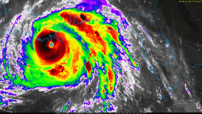
This morning, Hurricane Ida quickly grew to a Category 4 hurricane an hour after it strengthened to a Category 3. Ida is inching closer to Louisiana about 75 miles off the coast and will make landfall this afternoon. The eye of the hurricane in the photo above is very visible compared to yesterday’s update.
As the storm has intensified, the storm surge is dangerous and the National Hurricane Center says the surge could potentially be “9 feet or greater above ground level.” This is a life-threatening situation and residents should evacuate if officials have advised to do so.
The sustained wind speed are 150+ mph and will continue to strengthen until landfall. It is predicted that Ida will reach Tennessee early Tuesday afternoon and will continue to bring lots of rain into the overnight hours heading into Wednesday.
For more information on Ida, visit the NHC website here.

Subscribe to our FREE Newsletter


